File:Night City Area 2045 Map CPRED.png
Jump to navigation
Jump to search
Size of this preview: 614 × 600 pixels. Other resolution: 1,040 × 1,016 pixels.
Original file (1,040 × 1,016 pixels, file size: 1.27 MB, MIME type: image/png)
Summary
| Information on "Night City Area 2045 Map CPRED.png" | |
|---|---|
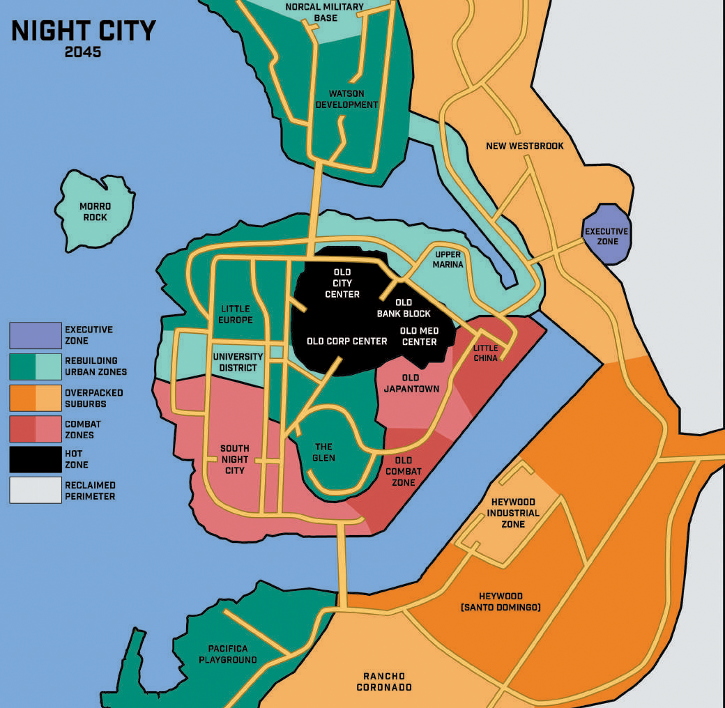
| Source | Cyberpunk RED (p.296) |
| Author(s) | R. Talsorian Games |
| Licensing | |
This file is copyrighted. The copyright holder has given permission for its use. | |
File history
Click on a date/time to view the file as it appeared at that time.
| Date/Time | Thumbnail | Dimensions | User | Comment | |
|---|---|---|---|---|---|
| current | 21:34, 3 September 2025 | | 1,040 × 1,016 (1.27 MB) | Admin (talk | contribs) | Backfill from remote (Fandom) via bot |
You cannot overwrite this file.
File usage
The following 27 pages use this file:
- Combat Zone (RED)
- Coronado Bay Bridge
- Del Coronado Bay
- Executive Zone
- Heywood (RED)
- Heywood Docks
- Heywood Industrial Zone
- Highway 828
- Hot Zone
- Little China (RED)
- Little Europe (RED)
- New Westbrook
- Night City
- NorCal Military Base
- Old Bank Block
- Old City Center
- Old Combat Zone
- Old Corporate Center
- Old Japantown
- Old Medical Center
- Pacifica (RED)
- Rancho Coronado (RED)
- South Night City (RED)
- The Glen
- University District (RED)
- Upper Marina (RED)
- Watson Development